Location of the Baseline.

  The 40th parallel of latitude runs around the world and separates Kansas from Nebraska in the USA.


The nearest meridian.

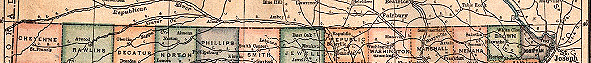
  The 6th Principal Meridian runs from the North Pole to the South Pole and divides two adjacent columns of Kansas counties (as depicted in the map section to the right).


The reference point.
  Right at the convergence of the Nebraska county of Thayer and the Kansas counties of Republic and Washington, the Baseline and the 6th Principal Meridian cross to provide a beginning point for land survey.
  In this picture, a red dot shows where the 6th Principal Meridian (longitude: 97o 22') intersects the Baseline (latitude: 40o N).

return to main page                                     Section 22


Section and Township   Baseline and Meridian   Townships and Ranges   Parallels